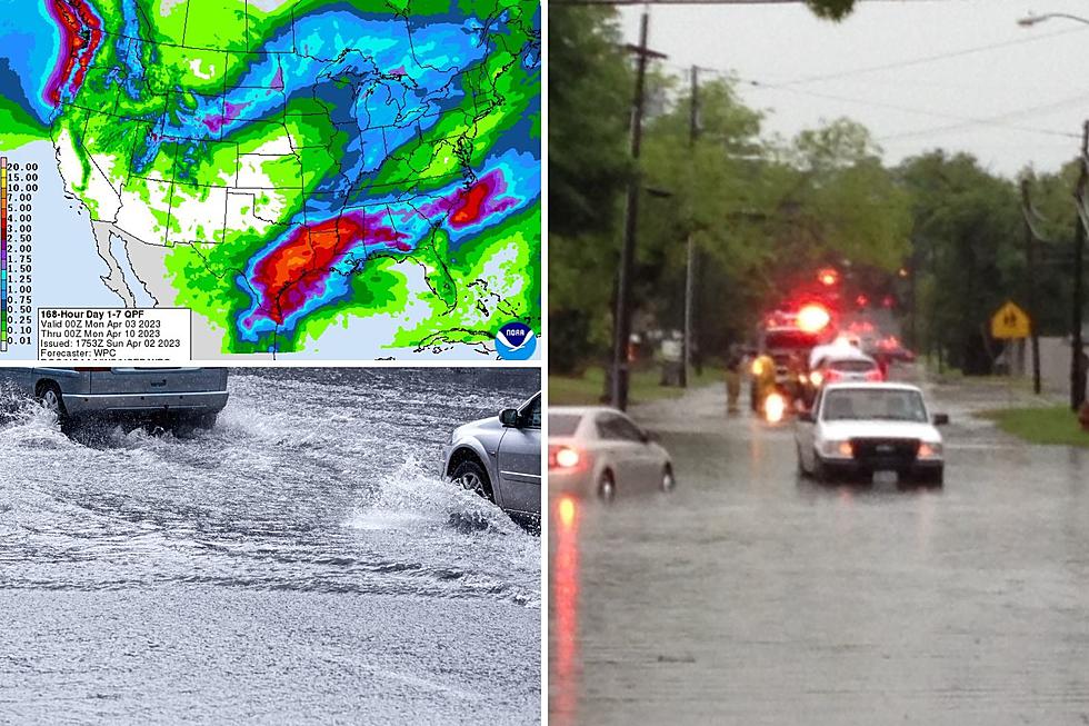
East Texas Soaker
A strong cool front is making its way across the mid-section of the United States and that will mean some relief from the above average temperatures by Wednesday. However, it also means showers and thunderstorms with some areas getting over 5 inches of rain.
Northeast Texas from Henderson to Texarkana seems to be the area that stands to get the heaviest rainfall from Monday afternoon through Wednesday morning with common rainfall amounts totaling 3-5 inches of rain. Deep East Texas will get amounts averaging 2-4 inches of rain. There could be higher isolated amounts. Severe weather may be an issue as well, but for now, the biggest threat is for flooding rainfall. A Flash Flood Watch is already in place beginning Monday afternoon for parts of Northeast Texas.
As always, listen to KICKS 105 for up to the second updates.
More From Kicks 105