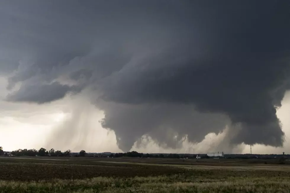
Tornadoes, Flash Flooding Possible Tuesday In East Texas
UPDATED 3/20, 8:15am
Heavy showers and some thunderstorms are moving across the Pineywoods. The heaviest rain is in Northeastern Nacogdoches county. Heavy storms also indicated south of Lake Livingston. Flash Flood Warnings have been posted for the Tyler/Whitehouse area. Also, a tornado warning for central Harris county (Houston) has been issued. A Flash Flood Watch continues until tomorrow morning for all of East Texas.
UPDATED 3/20, 6am
Heavy showers and thunderstorms continue to move into the Pineywoods this morning. The leading edge of these storms extends from near Longview to Alto to Kennard to Huntsville. Upwards of 5 inches of rain or more could fall in some areas of East Texas, a Flash Flood Watch is in effect until Wednesday morning. Severe storms are also a possibility even though there are no active warnings for the Pineywoods.
Heavy rain should start falling in the immediate Lufkin/Nacogdoches area around 7 this morning.
MONDAY, 3/19
There are several things you can count on in the Spring time in the Pineywoods -- yellow pollen on everything, beautiful azalea and dogwood blooms, and severe storms.
Tuesday and Tuesday night, it looks like we could be in store for up to 5 inches of rain in some areas of Deep East Texas. Isolated areas of large hail and tornadoes are also possible.
Here's the official statement from the National Weather Service:
A STRONG UPPER LEVEL DISTURBANCE WILL BE MOVING INTO WEST TEXAS BY
EARLY TUESDAY MORNING...WHICH WILL RESULT IN AN INCREASE IN SHOWERS
AND THUNDERSTORMS ACROSS DEEP EAST TEXAS...NORTHWEST AND NORTH
CENTRAL LOUISIANA...AND ADJACENT SOUTHERN ARKANSAS. STRONG WIND
SHEAR AND INSTABILITY WITH THIS DISTURBANCE WILL RESULT IN A
THREAT FOR DAMAGING WINDS...ISOLATED TORNADOES...AND EVEN SOME
LARGE HAIL FOR TUESDAY AND TUESDAY NIGHT. FLASH FLOODING WILL ALSO
BE POSSIBLE BY TUESDAY AFTERNOON...AS STORMS CONTINUE TO DEVELOP
AND MOVE ACROSS THE SAME AREAS REPEATEDLY. RAINFALL TOTALS THROUGH
THURSDAY MORNING OF 6 TO 8 INCHES ARE EXPECTED ACROSS PARTS OF
SOUTHERN ARKANSAS AND NORTHWEST LOUISIANA....WITH TOTALS OF 4 TO 5
INCHES EXPECTED ACROSS PARTS OF DEEP EAST TEXAS AND NORTH CENTRAL
LOUISIANA.
Now would also be a good time to make sure that you have loaded the free app 'Radio Pup' onto your smartphone. This allows you to listen to KICKS 105 and get all the weather updates should the power go out in your area.
More From Kicks 105