What to Expect in East Texas From the Approaching Cold Front
Changes are coming for East Texas weather...of course, that's always a given.
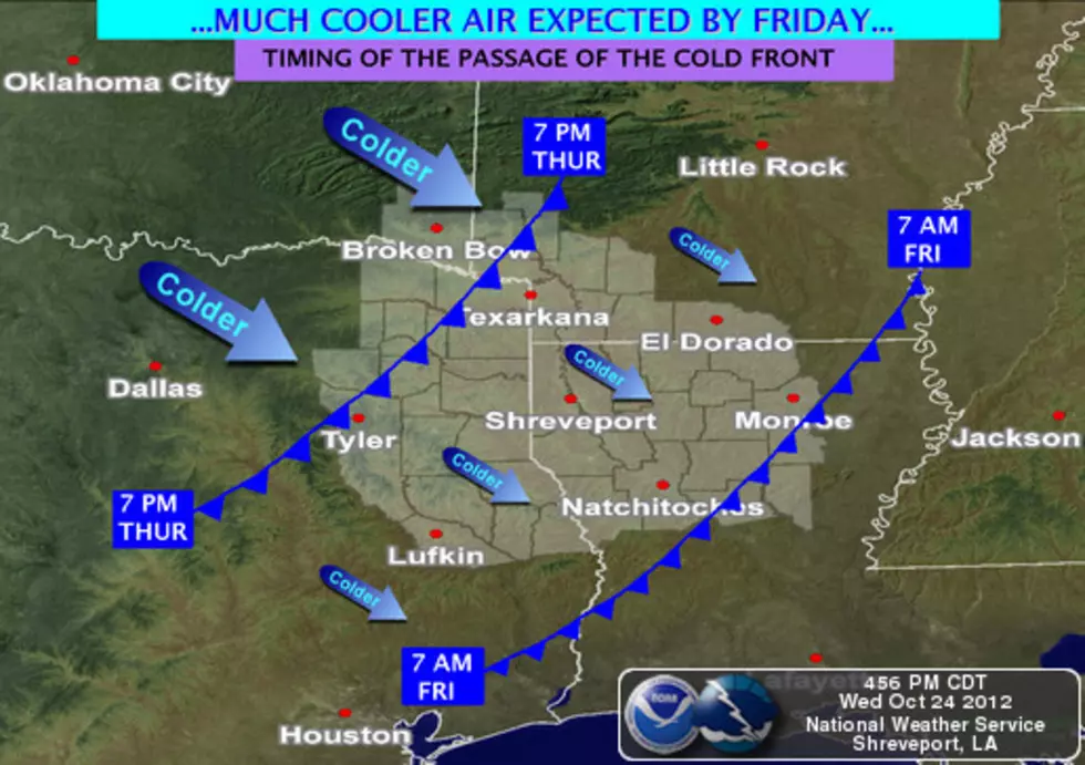
As of 2:30 Thursday afternoon, the leading edge of a strong mass of colder air was moving into the D/FW Metroplex. So, what can we expect for East Texas over the next few hours and into the weekend? Current forecasts show the leading edge of the cooler air should be getting into the Lufkin/Nacogdoches area between 8-10 o'clock this evening. Our rain chances will increase to 30% during the evening and overnight hours, and then jump to a 40% chance of showers throughout most of the day on Friday.
Things should clear out for Saturday and Sunday. As far as the temperatures are concerned, you can use the following graph to get a pretty good idea of where the temperatures are forecast to be over the next couple of days.
Thursday
Hour Temp
5pm 82
8pm 75
11pm 69
Friday
2am 65
5am 62
8am 59
11am 61
2pm 61
5pm 60
8pm 56
11pm 51
Saturday
5am 47
8am 49
11am 57
2pm 63
5pm 64
8pm 52
11pm 46
Sunday
2am 44
5am 41
More From Kicks 105