Rain, Severe Storms Possible in East Texas This Week
After a month of higher than normal temperatures and hardly any rainfall, it looks like the weather is starting to change. Scattered showers and storms have dotted portions of the Pineywoods over the past few days and more is on the way.
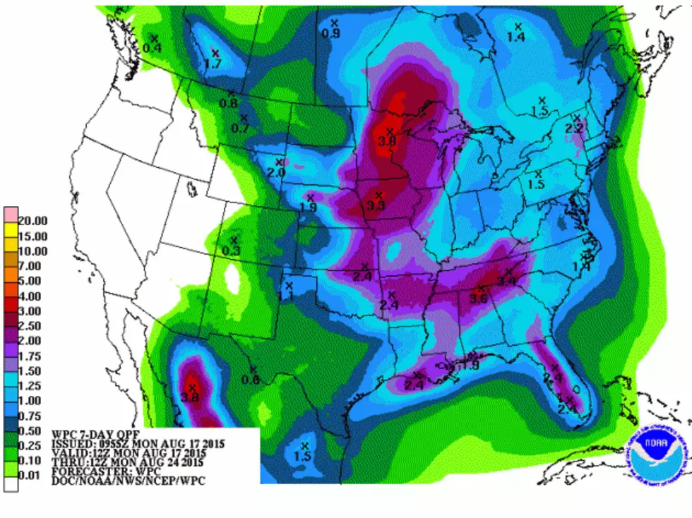
Today (Monday), daytime heating and an unstable air mass will lead to some pop up showers and thunderstorms across Deep East Texas. The best chance of rain for the week will happen on Wednesday and Thursday. A trough will move through the region and that will bring not only better rain chances, but the possibility of severe storms.
Through Sunday, forecasters are predicting about an inch of rainfall over the area with isolated higher amounts. Plus, we'll need to keep our eyes fixed on the tropics. It's been a while, but we have a disturbance forming in the distant Atlantic. It's still to early to pinpoint its path, but, if it keeps moving towards the west this system could bear watching for the Gulf of Mexico, especially by the late part of next week.
More From Kicks 105