What The Storm Prediction Center Did That Should Worry East Texas
During the last half of November, the Storm Prediction Center twice put East Texas on alert for the possibility of a severe weather outbreak. Meteorologists warned residents that some of the storms could bring hail and tornados.
Thankfully, the Pineywoods was spared. There were a few storms that popped up, but for the most part, it remained relatively quiet in East Texas while Louisiana bore the brunt of the severe weather.
Third Time a Charm?
Hopefully, our next severe weather scenario will be another dud, but I do have a bit more concern for this round of possible storms.
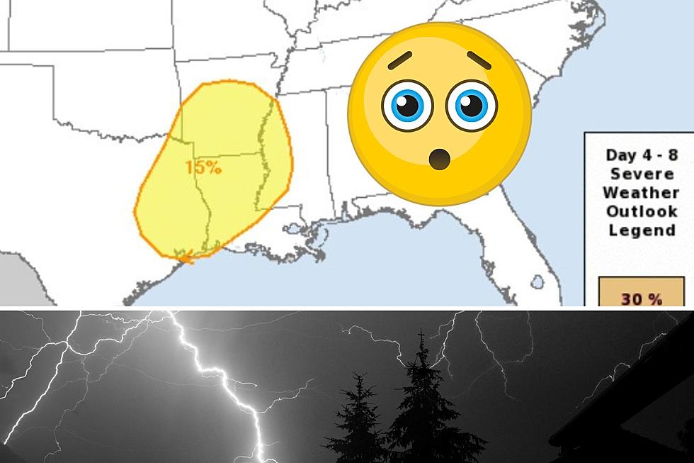
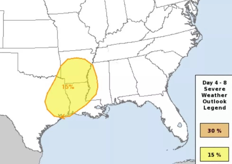
On Monday, December 4, the Storm Prediction Center (SPC) in Norman, Oklahoma issued their severe weather forecast for the next eight days. For day number six (Saturday, December 9), East Texas was included in a big yellow swath of a Level 2 out of 5 severe weather threat.
Why Am I Concerned?
Rarely do you see the folks at the SPC issue a Level 2 threat six days out. That's something you may see from time to time during the Spring when we have our biggest severe storm threats of the year.
What this means is that almost a week out from Saturday, various computer models were in agreement with the possibility of damaging winds, hail, and/or tornados from East Texas through Louisiana to Arkansas.
As we get closer to Saturday, I wouldn't be surprised for the SPC to raise the threat level to enhanced (3 of 5) for some parts of Texas, Louisiana, and/or Arkansas. We could be in for a very nasty Saturday afternoon and evening in Deep East Texas.
More Updates on the Way
Early Thursday morning, the 3-day severe weather outlook will be issued by the Storm Prediction Center. That should give us a better indication of whether the threat level is going up, holding steady, or diminishing.
I'll write up another in-depth look on Thursday if the outlook merits. In the meantime, be sure to download our station app to have weather alerts sent to your smartphone.

KEEP READING: Get answers to 51 of the most frequently asked weather questions...
More From Kicks 105


