East TX, Get Ready for Severe Storms, Heavy Rain And Colder Temps
Strong Cold Front Heads to East Texas
It's not that out of the ordinary for a late-season cold front to move through the Pineywoods. If memory serves me correctly, we've experienced mid to late-April cold snaps over the past couple of years, then we seem to jump straight into the heat of summer. We'll see if that plays out again this May.
This cold front will send the overnight temps to the low 40s by the weekend, but it will also set off some severe storms across Deep East Texas.
Not Happy With These Maps
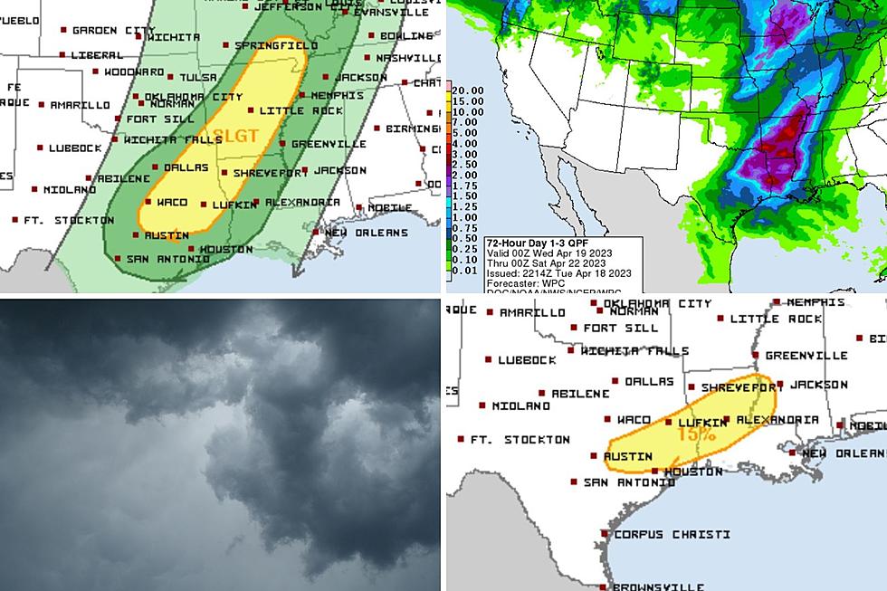
Let's start with this forecast map for Thursday.

The Storm Prediction Center puts cities such as Lufkin, Nacogdoches, Crockett, Center, and Livingston right in the middle of the highest threat of experiencing severe weather Thursday afternoon and night.
As of this posting, the biggest concerns are for damaging straight-line winds and isolated areas of large hail. Tornadoes are low on the probability scale, but that could always change.

Then, on Friday, the biggest threat of severe weather shifts a bit to the southeast as Tyler, Jasper, and Newton Counties get included in the mix. Based on the map above, Lufkin is still in the targeted area, but as you move further to the north, the chances lessen.
What About Rain?
Over a week ago, several areas around the Pineywoods received around 6 inches of rain. This system will bring downpours for sure, but according to the map below, 2-3 inches should be the maximum for most of our area.

Sneak Peek
Just a heads up, it looks like we could be in for another strong cold front for the final weekend of April.
As always, download our station app to keep up with weather alerts.

Little Rock Tornado Damage - March 31
Gallery Credit: Danny Merrell
Mesa Vista Ranch, Massive Estate of Texas Billionaire T. Boone Pickens
Gallery Credit: Lori Crofford/Danny Merrell
More From Kicks 105


