What the Hail? Severe Storms May Threaten East Texas This Weekend
Since Monday, I've been keeping a close eye on the weekend forecast for East Texas. The Texas Blueberry Festival is Friday and Saturday in downtown Nacogdoches, and there's a huge Reel United fishing tournament on Lake Sam Rayburn.
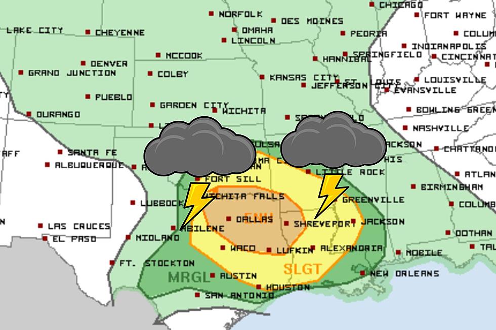
A slight chance of rain and higher temperatures were pretty much the expectations for Saturday in the Pineywoods. Then, all of a sudden, the Storm Prediction Center in Norman, Oklahoma has painted much of East Texas brown.

Anyone that lives in the area shaded in brown has an 'enhanced' chance of getting a severe storm, mainly during the afternoon and evening hours on Saturday. So, folks in Lufkin, Nacogdoches, and other areas to the north have the highest probability of seeing these severe storms.
Areas in the yellow-shaded regions, such as Livingston, Woodville, and Groveton, are still at risk for severe storms on Saturday, but the probability is a little lower.
How Bad Will it Get?
It looks like the main threat from these severe thunderstorms will be damaging winds in excess of 60 mph and large hail. The tornado threat across the state should be minimal. If any tornadoes do break out, those should be confined to Dallas/Fort Worth area.
Even though tornadoes are not expected across the Pineywoods, straight-line gusts can have wind speeds that equal those of twisters. The folks in Timpson can testify to that.
Once we get past the storm threat of Saturday, get ready for a rather significant heat wave. Temperatures are expected to reach nearly 100 by mid-week and no rain is in the forecast for Sunday through Friday.
The Ten Most Tornado-Prone Counties in America
Gallery Credit: Kelso
More From Kicks 105


