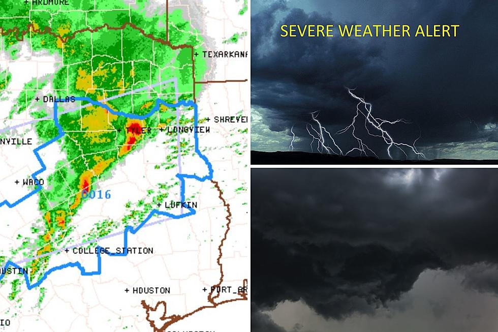
Severe Thunderstorm Watch Issued for Lufkin, Nacogdoches, East TX
The forecasted threat of severe thunderstorms across East Texas this Sunday morning is now happening. An impressive line of strong storms is developing across central and north-central Teas and moving eastward.
This has prompted the National Weather Service's Storm Prediction Center to issue a Severe Thunderstorm Watch for portions of East and Deep East Texas. This watch continues until 11 this morning.
The primary threats for these severe thunderstorms
- Scattered large hail events to 1.5 inches in diameter are possible
- Isolated damaging wind gusts to 65 mph are possible
- A tornado or two is possible
What to Expect and When
This corridor of strong to severe thunderstorms will continue to progress east-northeastward and move into the Tyler/Longview area between 6 and 9 this morning, and across the Lufkin/Nacogdoches area between 8 and 11 this morning.
The most intense storms will be capable of producing large hail and localized strong
wind gusts. A rogue, short-lived tornado or two is also possible along the watch area.
Which Counties Are Under the Severe Thunderstorm Watch?
The severe thunderstorm watch area is approximately along and 70
statute miles north and south of a line from 55 miles west of Temple, Texas to 30 miles southeast of Longview.
Deep East Texas counties included are:
- Angelina
- Nacogdoches
- Shelby
- Panola
- Cherokee
- Rusk
- Houston
- Trinity
- Anderson
Although counties such as San Augustine, Sabine, and Polk Counties are NOT included in this watch. Strong to severe storms are still a possibility there later in the morning and early afternoon. A second severe storm watch may be issued for these counties later.
Keep up to date with rapidly changing weather in your area. Download our station app to weather alerts sent straight to your smartphone.

Insects That Are Beneficial Found in Texas
Gallery Credit: Billy Jenkins
More From Kicks 105


