
Updated Forecast Raises the Threat of Severe Weather Across East Texas
The threat of severe weather across northeast Texas and parts of the Pineywoods has increased.
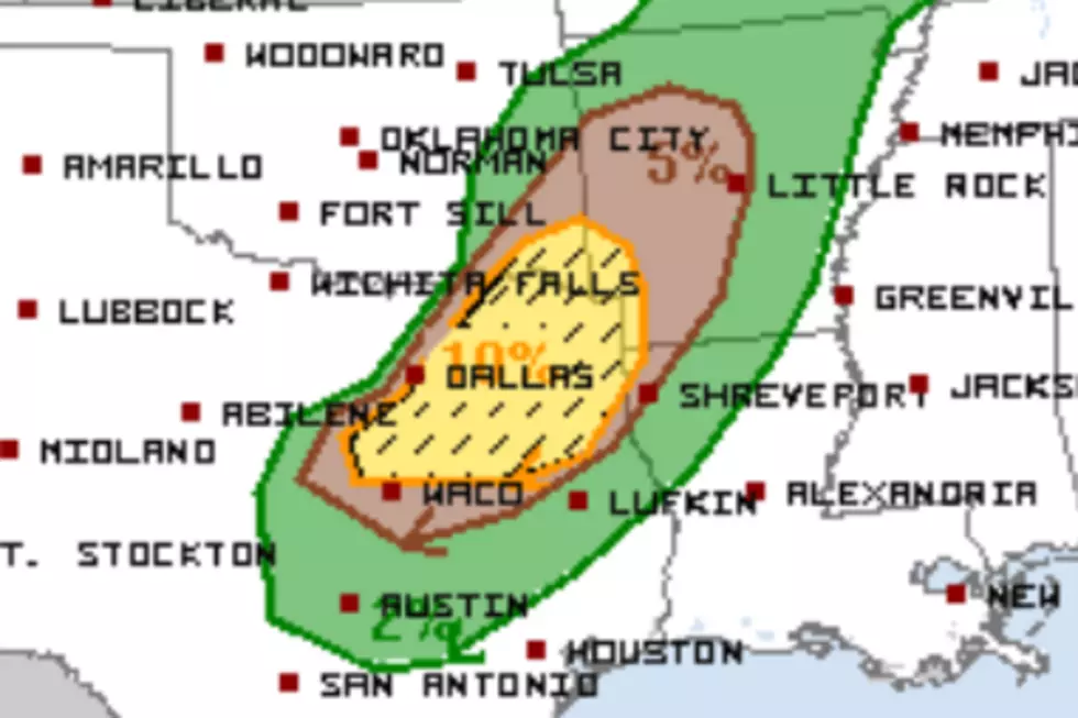
The Latest Outlook From the Storm Prediction Center
Severe storms are already occurring today across north-central and northeast Texas. This threat is expected to continue as the system pushes northeastward.

READ MORE: Texas County Experiences Intense Tornado, Record Heat, and Blizzard Warning in Less Than 30 Days
The region from Texarkana to Marshall to Tyler and westward should see the most widespread severe weather events.
Unfortunately, that includes a raised risk of EF2 or stronger (111+ mph) tornadoes, designated by the hatched area in the map below.
Severe Weather Warnings Have Already Been Issued
As of 12 pm, the National Weather Service in Fort Worth has issued several warnings, including severe Thunderstorms, flash floods, and one tornado warning for an area near Paris, Texas.
A tornado watch is in place until 5 pm for the Tyler/Longview area and northward. A second tornado watch, this one for areas between Lufkin and Tyler, is expected to be issued later this afternoon
Severe Weather Outlook for Friday
The Storm Prediction Center expects the severe storm threat to push further south and east on Friday. Lufkin, Nacogdoches, and several other Deep East Texas counties are in the yellow-shaded region. (risk 2 of 5)
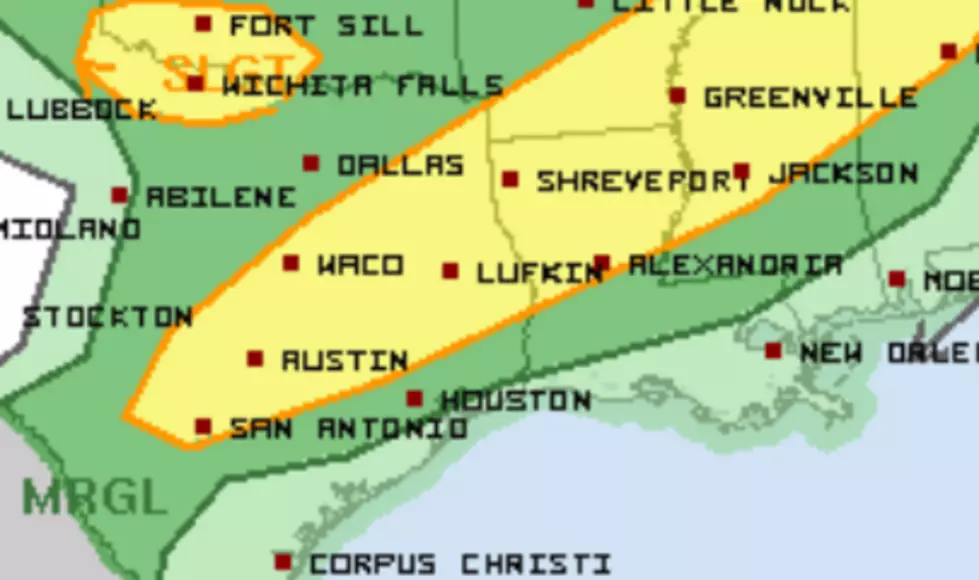
Damaging large hail appears to be the biggest threat from Friday's storms. A swath from Austin to Lufkin is predicted to have the highest risk of experiencing these large-hail events.
The rain chances will lessen on Saturday and be out of the picture for Sunday.
Odd and Unbelievable Tornado Facts
Gallery Credit: Kelso
More From Kicks 105


