Stormy in East Texas Tonight, Then a Dangerous Forecast on Monday
First things first...I'm just the messenger, I didn't forecast the nasty weather I'm about to write about. So, please don't hold me in contempt.
A Look Back
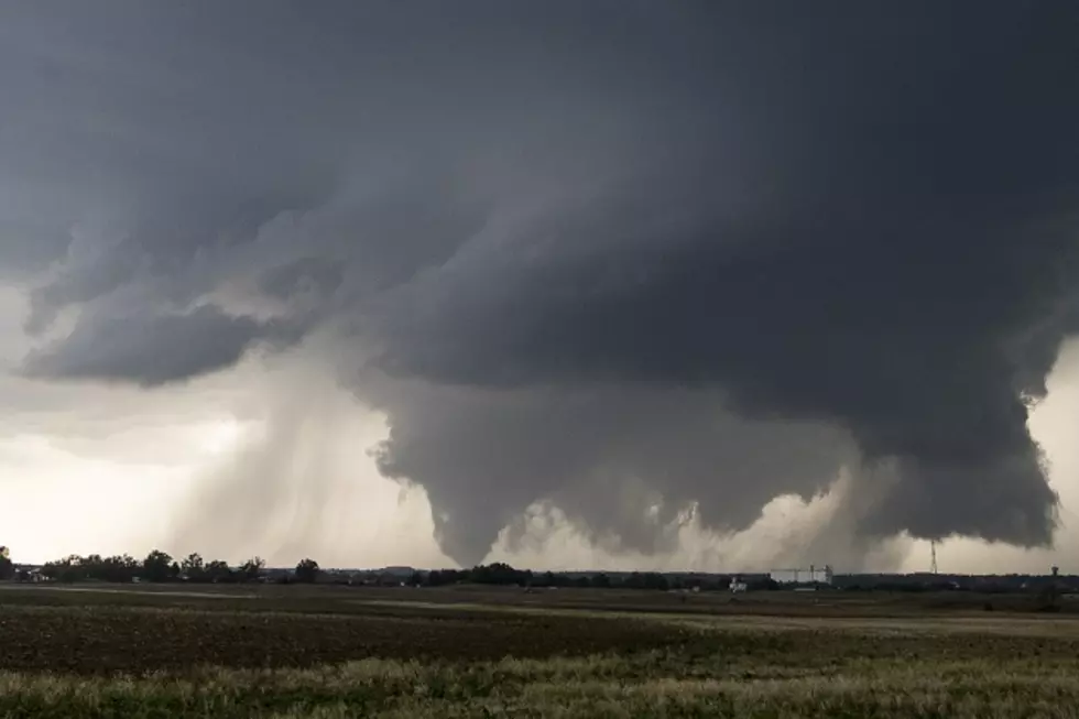
This past Monday night, parts of Deep East Texas were hit with some severe storms. Trinity and Angelina Counties received the brunt of the nasty weather as several Severe Thunderstorm Warnings and Tornado Warnings were issued for the area.
A line from Apple Springs to Lufkin to Huntington received hail the size of golf balls and damaging winds. The extremely heavy rain that fell in less than an hour posed flooding problems for a while in parts of Lufkin.


What about Tonight?
Another cold front is expected to move across the Pineywoods late tonight. Ahead of that boundary, some storms are expected to develop late this afternoon and into the evening hours across Deep East Texas. A few of those storms could be rather strong or even severe.
The biggest threat from the storms tonight will be hail (up to golf-ball sized) and damaging winds gusting to 60 mph. A tornado cannot be ruled out, however, the biggest threat of tornadoes will be east of Lufkin and Nacogdoches. Louisiana and southern Mississippi are expected to catch the worst of the strongest storms from this system.
What about Next Week?
The good news is we should get a really nice weekend with highs in the 70s and lots of sunshine.
The bad news is Monday is looking scary. We're still four days out from Monday and already the Storm Prediction Center (SPC) in Oklahoma is forecasting that an area bounded by Austin to Dallas to Shreveport and back to Lufkin will be the bulls-eye for a dangerous severe storm outbreak beginning Monday afternoon and continuing into the morning hours of Tuesday. Usually, the SPC doesn't target an area like that until we get 48 hours away from the storms. So, as of now, it looks to be very likely that parts of Deep East Texas will get some 'warned weather' on Monday.
How bad will the weather get? As of now, the National Weather Service in Shreveport is forecasting the following:
- We have a medium potential for tornadoes (that's the highest potential we've had in quite a while)
- We could get hail up to the size of tennis balls
- Damaging straight-line winds with gusts up to 80 mph
- Heavy downpours that could cause some localized flooding
Take a look at the area highlighted in brown in the map below. In the next 2 to 3 days, it's likely that the SPC will focus an area of red within that brown circle. That will be an area in which the worst of the severe weather outbreak is expected to happen. Hopefully, the Pineywoods won't find themselves in that possible circle.

Forecasters haven't mentioned anything yet about the possibility of strong (F2 and above) and long-track tornadoes, but I wouldn't be surprised to see that added to the narrative sometime soon.
I'm not happy about this either. During this past Monday's storm, I ended up corralling four dogs into a bathroom when a tornado warning was issued. I don't want to go through that again.
In the meantime, pray that the good Lord keeps you safe and listen to KICKS 105 for weather updates. Download our free KICKS 105 App as well so that you can receive breaking weather alerts on your smartphone.

Awesome Nacogdoches County Home Listed for $1.5 Million
Gallery Credit: Danny Merrell
More From Kicks 105


