Severe Weather Possible in the Pineywoods Saturday Night
Over the past few days, we've been letting you know of a possible severe weather outbreak that's expected to hit the Deep East Texas area on Tuesday. Damaging straight-line winds, large hail, and strong tornadoes are all in the mix as a major cold front approaches our area.
For the past 48 hours, the chance of rain and storms has also been increasing for this weekend, specifically for late Saturday night and into the early morning hours of Sunday. A weak cool front is expected to set up some storms and a few of those could be severe.

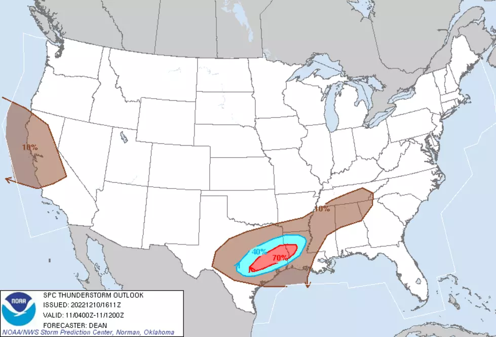
This SPC map above gives the possibility of a thunderstorm happening within 12 miles to a point. You'll notice that most of deep East Texas is within the red-shaded area, which means that if you live in Lufkin, Nacogdoches, Livingston or anywhere nearby, you have a 70% chance of a thunderstorm rumbling near you late tonight or early Sunday morning.
That 70% probability is expected to happen sometime between 11 pm and 7 am. There is a small chance that a few of these thunderstorms could reach severe limits, even a brief, pop-up tornado is not out of the question. However, that should be the exception rather than the rule.
Regardless, a severe storm threat, no matter how remote, should never be taken lightly. Make sure you are prepared and please download our free station app to have weather alerts sent straight to your smartphone.

We will also provide another update by Monday morning for the major severe threat that is expected on Tuesday afternoon.
KEEP READING: Get answers to 51 of the most frequently asked weather questions...
More From Kicks 105


