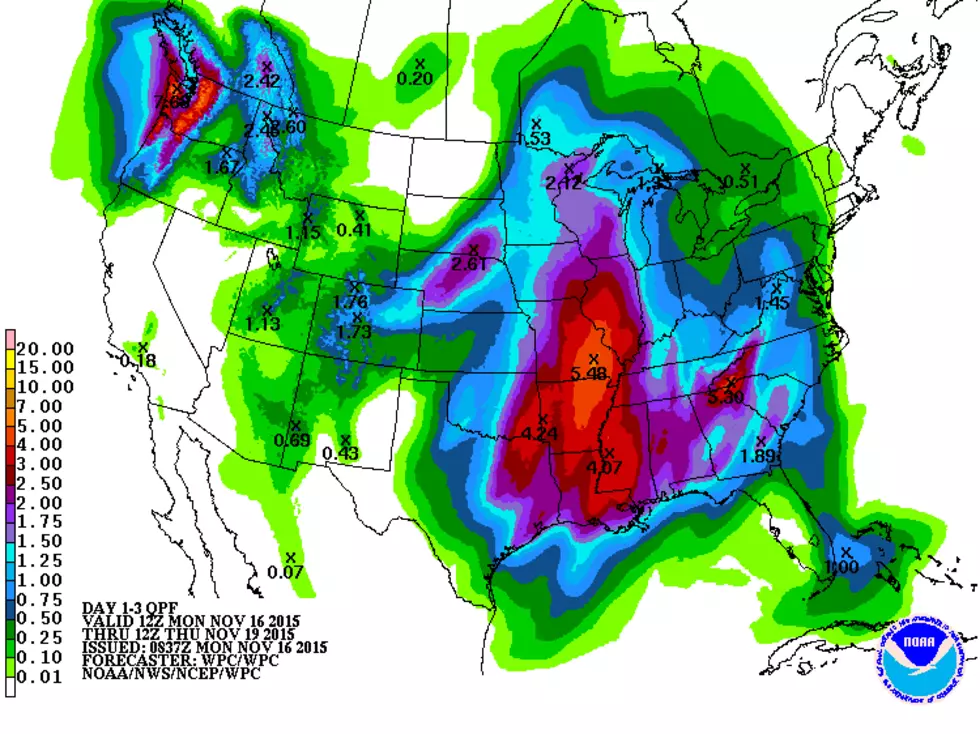
It looks like East Texas is in for a '1-2 weather punch' over the next several days as a series of storms is expected to bring the possibility of severe storms and multiple heavy downpours.
Heavy rain and severe storms should spread throughout the East Texas area on Tuesday. In fact, the National Weather Service has issued a Flash Flood Watch which is in effect Tuesday from 6 AM until Midnight.
CAUTION - explicit language in video
8 to 15 inches of rain and scattered reports of tornadoes greeted residents of San Marcos, Wimberley, Austin, and surrounding areas Friday morning.
Tuesday morning brought heavy downpours across parts of East Texas. Huntington and Crockett each received about an inch and a half of rain. If the forecast is correct, we could be in for a lot more.
A weak cool front is expected to make its way across East and Northeast Texas this afternoon and overnight bringing with it the possibility of strong to severe storms.
Don't put away the heavy jackets just yet. A strong cold front has stormed across East Texas Monday morning bringing temperatures into the 50s with wind chills 10-15 degrees below that. And now we have the possibility of ICE??!!
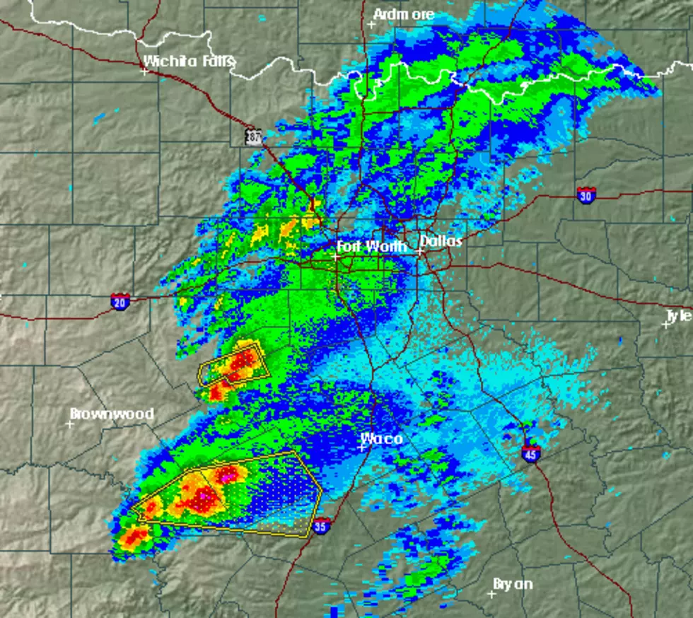
Early this Friday afternoon severe storms are starting to pop up across the Hill Country and North Central Texas, and forecasters are expecting some of the storms to bring nasty weather to the Pineywoods by later this afternoon and evening.
It seems that most of the folks I've talked to are more than ready for Spring to get here. The warmer weather is welcome especially when considering the 4 ice/snow events that we had over the past 2 months.
Be careful what you wish for.
As the afternoon progresses, widespread showers and thunderstorms should start popping up across East Texas. Some of these storms could get to severe levels.