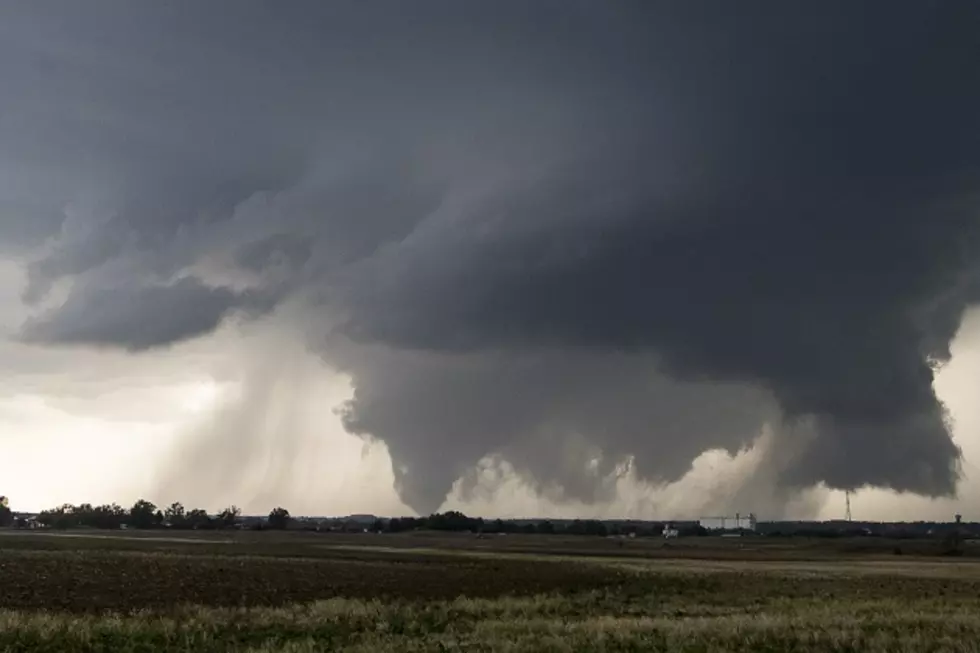
Tornado Watch Issued for East Texas, Intense Tornadoes Possible
Tornado Watch for the Pineywoods
The Storm Prediction Center in Norman, Oklahoma has issued a Tornado Watch effective until 4 p.m. for a large portion of Deep East Texas.
The watch area includes Angelina, Nacogdoches, Cherokee, Houston, Trinity, Polk, Tyler, Jasper, Newton, San Augustine, Sabine, Shelby, Panola, and Rusk Counties. Most of the Ark-La-Tex is also included in the Tornado Watch.
That Escalated Quickly
As of early this morning, forecasters expected the worst of the severe weather threat to be over Louisiana. However, the latest atmospheric analysis shows that there is a moderate chance of strong to severe thunderstorms producing damaging straight-line winds to EF2 or stronger tornadoes.

As of 9:30 a.m., several lines of showers and thunderstorms have developed across the Brazos Valley, northeast Texas, and Deep East Texas. None of these storms have reached severe limits. However, atmospheric conditions are expected to be conducive to the development of strong to severe storms throughout the mid-morning to early-afternoon hours.
Be Prepared
Now is the time to go through your checklist of what you and your family should do if damaging straight-line winds or a tornado threatens your home. Remember, a mobile home provides no safety in the event of a tornado.
The severe weather threat should end throughout the Pineywoods as we get to the evening hours. We are expecting cooler weather with clear skies overnight with a low into the 40s. Rain chances will return by the weekend, but, at this time, no severe weather is forecast for that rain event.
Download the KICKS 105 App to have weather alerts sent to your smartphone.

Damage from Hurricane Ike
Gallery Credit: Danny Merrell
LOOK: The most expensive weather and climate disasters in recent decades
Gallery Credit: KATELYN LEBOFF
More From Kicks 105